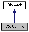
Details of a single S-57 cell. More...
import"encxcom.idl";

Properties | |
| IS57CellIdentifier | CellIdentifier [get] |
| Unique label for an S-57 cell. More... | |
| LONG | IntendedUsage [get] |
| Can be combined with CellIdentifier::Product to form a ProductIntendedUsage. More... | |
| LONG | CompilationScale [get] |
| The nominal scale. The cell should contain a reasonable amount of detail when drawn at this scale. More... | |
| BSTR | Agency [get] |
| Description of the S-57 data producer. 1:1 correspondence with the Agency code in IS57FeatureIdentifier::Agency. More... | |
| BSTR | Country [get] |
| Name of the country providing the cell. More... | |
| BSTR | VerticalDatum [get] |
| Description of the vertical datum used for land heights. See SoundingDatum for the vertical datum used for sea depths and drying heights. More... | |
| BSTR | SoundingDatum [get] |
| Description of the vertical datum used for sea depths and drying heights. More... | |
| IGeoRect | Extent [get] |
| The geographical bounding rectangle defined by two parallels and two meridians that encloses the features in the cell. More... | |
| DATE | IssueDate [get] |
| When the cell was released. More... | |
| DATE | LastChanged [get] |
| When the cell was last modified in the SENC. More... | |
| LONG | Edition [get] |
| S-57 allows a cell to be completely replaces instead of being updated. More... | |
| LONG | LatestUpdate [get] |
| Cell updates are numbered sequentially. 000 indicates a base cell. 001 is the first update. More... | |
| DATE | PermitExpiryDate [get] |
| When the licence expires for this cell. More... | |
| VARIANT_BOOL | PermitIsSubscription [get] |
| Returns true iff a permit is required for this cell. More... | |
| LONG | LeastDetailedDisplayScaleToShow_All [get] |
| Whether the contents of a cell is displayed depends on the relationship between the IS57Draw::DisplayScale and the compilation scale of the cell. More... | |
| LONG | LeastDetailedDisplayScaleToShow_GroupOne [get] |
| Whether the contents of a cell is displayed depends on the relationship between the IS57Draw::DisplayScale and the compilation scale of the cell. More... | |
| LONG | LeastDetailedDisplayScaleToShow_Coverage [get] |
| Whether the contents of a cell is displayed depends on the relationship between the IS57Draw::DisplayScale and the compilation scale of the cell. More... | |
| BSTR | LongFileName [get] |
| Empty for most ENC suppliers, useful text from NOAA. More... | |
Detailed Description
Details of a single S-57 cell.
This information is generally metadata. The features and geometry within a cell are obtained using IS57FeatureQuery.
Definition at line 2049 of file encxcom.idl.
Property Documentation
◆ Agency
|
get |
Description of the S-57 data producer. 1:1 correspondence with the Agency code in IS57FeatureIdentifier::Agency.
◆ CellIdentifier
|
getproperty |
Unique label for an S-57 cell.
◆ CompilationScale
|
getproperty |
The nominal scale. The cell should contain a reasonable amount of detail when drawn at this scale.
◆ Country
|
getproperty |
Name of the country providing the cell.
◆ Edition
|
getproperty |
S-57 allows a cell to be completely replaces instead of being updated.
Each replacement is a new edition. A new edition resets the update number.
◆ Extent
|
getproperty |
The geographical bounding rectangle defined by two parallels and two meridians that encloses the features in the cell.
◆ IntendedUsage
|
getproperty |
Can be combined with CellIdentifier::Product to form a ProductIntendedUsage.
◆ IssueDate
|
getproperty |
When the cell was released.
◆ LastChanged
|
getproperty |
When the cell was last modified in the SENC.
◆ LatestUpdate
|
getproperty |
Cell updates are numbered sequentially. 000 indicates a base cell. 001 is the first update.
◆ LeastDetailedDisplayScaleToShow_All
|
getproperty |
Whether the contents of a cell is displayed depends on the relationship between the IS57Draw::DisplayScale and the compilation scale of the cell.
At LeastDetailedDisplayScaleToShow_All scale or any more detailed scale all features (unless excluded by SCAMIN) are drawn.
◆ LeastDetailedDisplayScaleToShow_Coverage
|
getproperty |
Whether the contents of a cell is displayed depends on the relationship between the IS57Draw::DisplayScale and the compilation scale of the cell.
Between LeastDetailedDisplayScaleToShow_Coverage scale and LeastDetailedDisplayScaleToShow_GroupOne scale only the coverage feature (M_COVR) is drawn.
At any less detailed scale than LeastDetailedDisplayScaleToShow_Coverage nothing from this cell is drawn.
◆ LeastDetailedDisplayScaleToShow_GroupOne
|
getproperty |
Whether the contents of a cell is displayed depends on the relationship between the IS57Draw::DisplayScale and the compilation scale of the cell.
Between LeastDetailedDisplayScaleToShow_GroupOne scale and LeastDetailedDisplayScaleToShow_All scale only the 'skin of earth' features (DEPARE, LNDARE etc.) (unless excluded by SCAMIN) are drawn.
◆ LongFileName
|
get |
Empty for most ENC suppliers, useful text from NOAA.
◆ PermitExpiryDate
|
getproperty |
When the licence expires for this cell.
◆ PermitIsSubscription
|
getproperty |
Returns true iff a permit is required for this cell.
◆ SoundingDatum
|
getproperty |
Description of the vertical datum used for sea depths and drying heights.
◆ VerticalDatum
|
getproperty |
Description of the vertical datum used for land heights. See SoundingDatum for the vertical datum used for sea depths and drying heights.