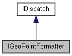
GeoPointFormatter. More...
import"encxcom.idl";

Properties | |
| VARIANT_BOOL | UseUniversalGrid [get, set] |
| Show the position using the UTM or MGRS universal grid, where available. More... | |
| VARIANT_BOOL | UseNationalGrid [get, set] |
| Show the position using a national grid, where available. When set, this has priority over UseUniversalGrid. More... | |
| LatLonFormat | Format [get, set] |
| The format to use for latitude and longitude values. This does not affect grid formats. More... | |
| UniversalGridType | UniversalGrid [get, set] |
| The universal grid format to use. More... | |
Detailed Description
GeoPointFormatter.
A class to allow different forms of geographic positions to be output by the GeoPoint.FormattedPosition property.
Note that when both UseUniversalGrid and UseNationalGrid are set to true, UseNationalGrid has priority.
The universal grid used is UTM and this gives global coverage apart from at high latitudes.
When there is no grid coverage, FormattedPosition returns the position using the designated Lat-Lon format.
Definition at line 279 of file encxcom.idl.
Property Documentation
◆ Format
|
getset |
The format to use for latitude and longitude values. This does not affect grid formats.
◆ UniversalGrid
|
getset |
The universal grid format to use.
◆ UseNationalGrid
|
getset |
Show the position using a national grid, where available. When set, this has priority over UseUniversalGrid.
◆ UseUniversalGrid
|
getset |
Show the position using the UTM or MGRS universal grid, where available.